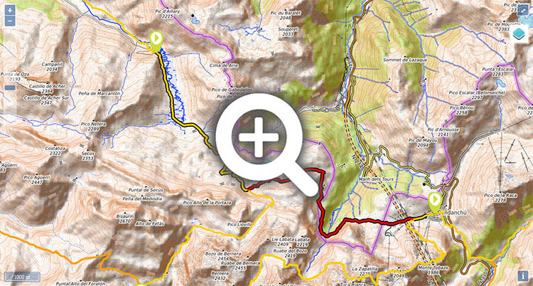
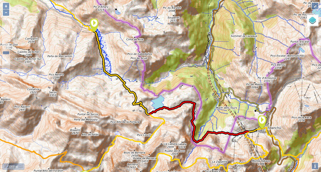
Stage 10 (discontinued): Aguas Tuertas - Candanchú

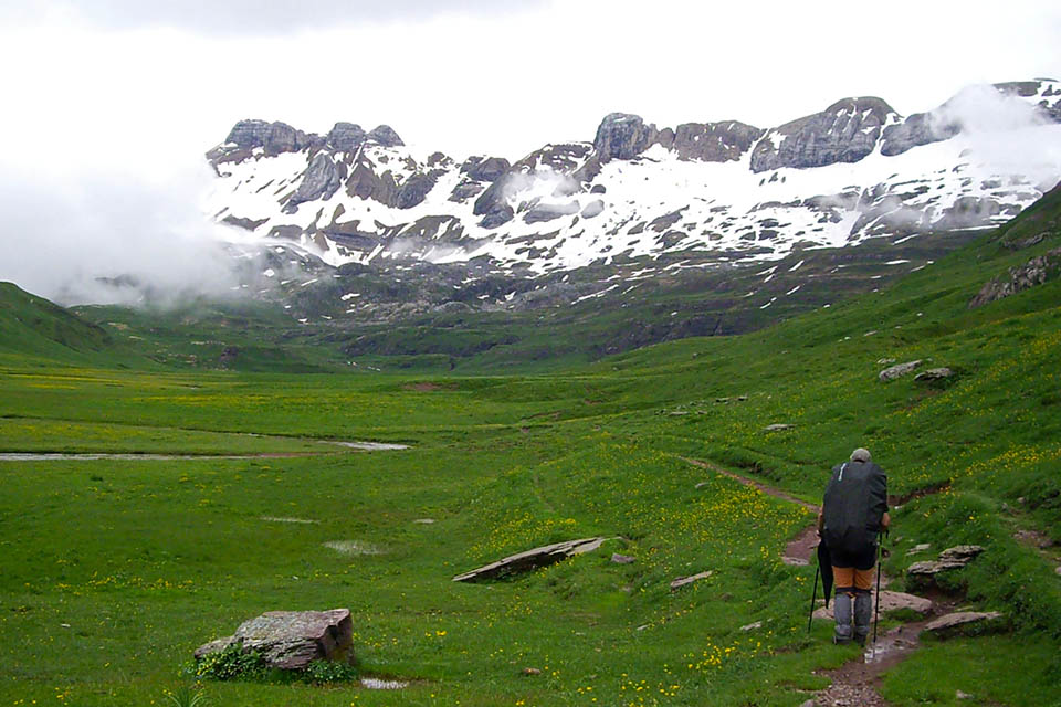
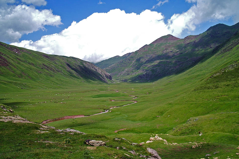
(0h0min; 0kms) Aguas Tuertas (1,620m). The valley in Aguas Tuertas is undoubtedly one of the most picturesque in the whole of the Pyrenees. The river zigzags drawing impossible meanders across an idyllic meadow surrounded by mountains. It is a place that exudes an incomparable sense of peace and serenity. The path heads towards the head of the valley on the left-hand side, where water flows from Barranco de la Rueda. Shortly before, the path turns left (east) and looks for a good place to cross the river (not always easy), on the way to...
(0h50min; 2.9kms) Escalé Pass (1,660m). A signpost signals left to Escalé pass and right to Estanés lake (GR11). You head on up to a col.
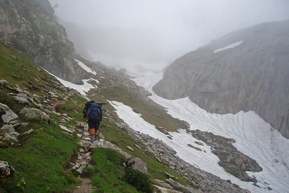
(1h35min; 4.8kms) Toronez d'as Cabretas (1,910m). Then take a short descent. Keep a keen eye on waymarking – especially in foggy conditions – so as to avoid walking down to the lake, because you need to skirt round it half-way up in order to avoid the walls that surround it on this side.
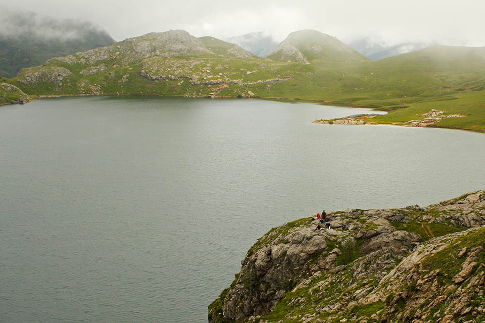
(2h05min; 6kms) Ibón de Estanés (crossing) (1,806m). Signpost. The new section of the GR11 no longer goes down to Estanés lake. Instead, it continues towards Lizara mountain refuge across the Valle de los Sarrios. At this point, you ignore the red and white markings and continue along a marked path (green and yellow, belonging to the Camille Trail) that heads towards the lake shore. You leave it to the left and head towards...
(2h25min; 7.2kms) Puerto de Estanés (1,792m), to the east of the lake. Before that you will pass a stream The trail – clearly marked – coincides with other walks that drop down towards the car park at Sansanet, in France. On the descent, 1.4 kilometres from Estanés pass, you need to take care not to miss a path that takes a sharp right turn (Camille Trail). The crossing comes shortly after crossing the stream that you have been following, after a short rise. The path starts out on the hillside, revealing magnificent vistas over the peaks that stand proud above the Aspe valley.
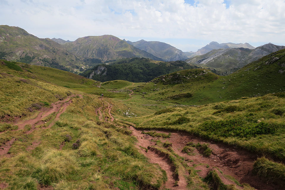
(3h00min; 9.6kms) Frontier - Bosque de Sansanet (1,607m). Just before entering Sansanet forest (Parc National des Pyrénées), you cross over a perfect stream for taking on water. The path continues steadily along the hillside, towards Chorrota de Aspe, where you leave the shelter of the woods, and soon afterwards pass a section where a landslide forced the path to be diverted. Further on, the path passes through another section of woodland. On the way out, you come to a little stream and shortly afterwards, a drinking fountain. Just a short climb awaits up to Causiat pass (1,630m), a border post with ski slopes, followed by a gentle descent to Candanchú.
(4h30min; 14.3kms) Candanchú (1,550m).
At the beginning of the Aguas Tuertas Valley, you will find the Aguas Tuertas cabin (free, in good condition, basic).
In Candanchú a number of auberges and hotels are open, depending on the time of year. We recommend: Apartamentos Candanchu 3000 (Tel: +34 976 10 13 32; booking@apartamentos3000.com) and Albergue Aysa (Tel: +34 974 373 023; aysa.somport@gmail.com), in Somport (1km).
Transport:Between Candanchú and Jaca, there is a regular line on the Mancomunidad Alto valle del Aragón local route. You will find information on timetables on the Comarca de la Jacetania website.