Stage 9: Zuriza - Aguas Tuertas
Difficulty: A stage with no apparent difficulty, except for the elevation itself and the distance. The route is well waymarked and the way through the valley is self-evident.
Water: Throughout the stage, apart from at the highest point, you will come across streams to take water from.
Advice: The stage ends at the open refuge in Aguas Tuertas. Plan ahead, and take a sleeping bag, floor mat and food for the night, and even for one more night, to get you to Sallent de Gállego. The last time we passed through Candanchú, all the shops were closed. The auberges in Candanchú provide dinner and breakfast and also prepare lunch packs. In Zuriza, the campsite has its own store.
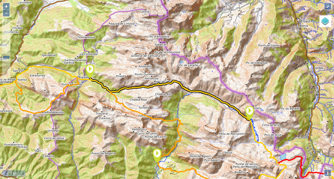
(0h0min; 0kms) Zuriza (1.223m). Take the track that begins just below the campsite on a horse-shoe bend (GR11 panel), towards Petraficha ravine. To the left are the slopes of Quimboa, and to the rights lies Ruzquia Peak (2074m). The elongated Sierra de Alano, which bears an uncanny resemblance to the Dolomites, begins here. The uphill climb along the track to Taxeras car park is gentle, and along the way you pass a couple of small streams and a drinking fountain where you can fill up with water.
(0h30min; 2.8kms) Llano de Tacheras (1.283m). Just before reaching the car park, you leave the track and follow a path that heads upwards on the left. The path takes a large bend and crosses a passage for cars GR11.1 via the Cuello de Estribiella, after wich there is a drinking fountain by the river on the left. After 5min you pass an area with ruins and 10min later you reach Taxeras refuge (in poor condition). From this point on, the GR winds its way up the Petraficha ravine on the right-hand side until reaching...
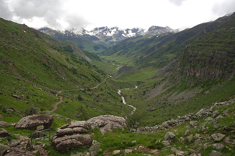
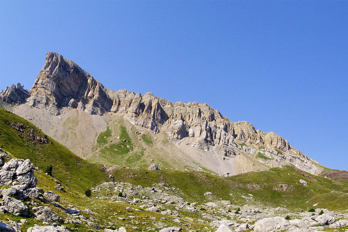
(2h20min; 7.2kms) Petraficha col (1.963m). Petraficha (2186m) lies to the north and Chipeta Alto (2175m), easily accessible, to the south. The path heads decisively down – the views are stunning towards Acherito ravine and the Aragón Subordán valley. Close to the bottom of the descent, you pass the Sabucar refuge (barn), then the path zig zags for a while until it meets a track at the point where a bridge crosses the stream coming from the Acherito and Las Foyas ravines.
(3h55min; 11.7kms) Guarrinza - La Mina bridge-car park (1.225m). By the bridge there is a series of panels which provide information on the ruins of the Mine house (once a military patrol house) as well as the GR65.3.3, a variant of the Camino de Santiago crossing Puerto de Palo. From here, if you take the right-hand track, you follow the Camino de Santiago and the old route of the variant GR11.1. You take the left-hand fork and head on towards Aguas Tuertas and Candanchú. Some 10 minutes later you walk past the old military post of La Mina where you can see a number of buildings, some of which are ruins, others used for livestock, and the only one in good condition is closed. After another 10 minutes you pass a walkway on your right which gives access to the track. The route heads up the left-hand side of the Aragón Subordan, crossing an area rich in megalithic remains. After an hour, you cross the d'os Chitanos bridge from the walkway and 15min later you come to the track. Instead of following it, you take on the last section of the climb to Achar de Aguas Tuertas via the short-cuts.
(5h50min; 18,8 kms) Aguas Tuertas (1.620m).
In Zuriza there is the Zuriza Campsite-Auberge (/) . Below the campsite there is an open shelter (2 floors, reasonable condition).
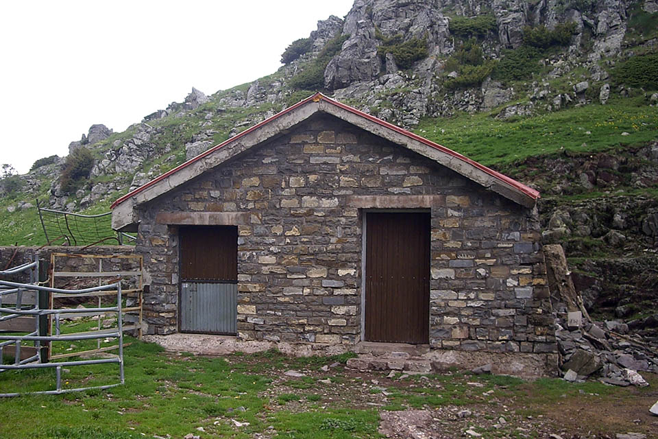
During the stage, between Zuriza and Guarrinza you have the refuges in Taxera (por condition, 8 places), Chipeta Alto (free, acceptable) and lo Sabucar (barn, very dirty).
In Guarrinza, on the left-hand side, opposite the Military Post of La Mina you will find La Cantina or Refugio Guarrinza (open, good condition, municipally owned – above the door it says “no entry”).
At the end of the stage, when you enter the Aguas Tuertas valley, you will see the Aguas Tuertas cabin (free, good condition, 4-5 people max).
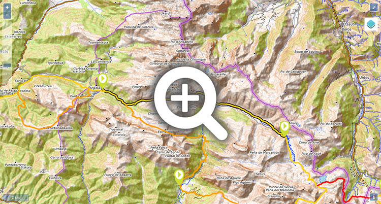
Maps:
- Alpina:
Valles de Ansó y Echo
(Scale: 1/25.000).
- Prames:
Valles occidentales - Ansó y Echo
(Scale: 1/25.000).
The only way to get to Zuriza or Selva de Oza is by taxi. Taxis are bases centrally in Jaca () . To get to Ansó, Echo and Siresa from Jaca, Autobuses Escartín ().

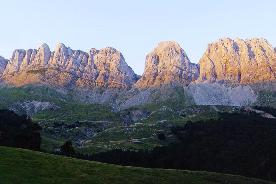
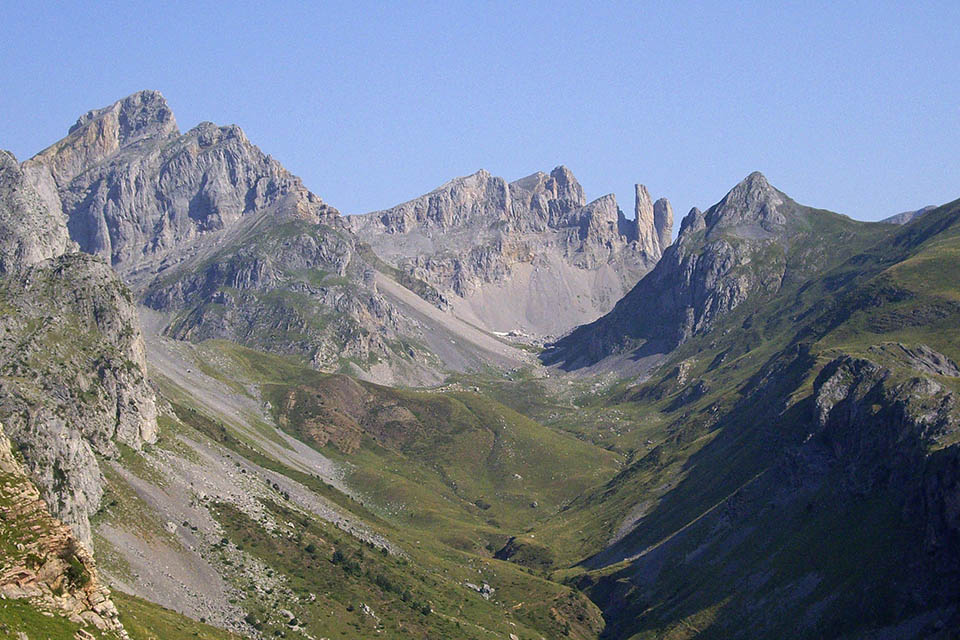
Los Alanos vistos desde las inmediaciones de Zuriza. En el centro, el Achar de Alano.
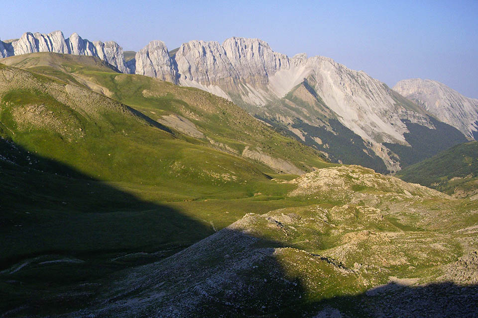
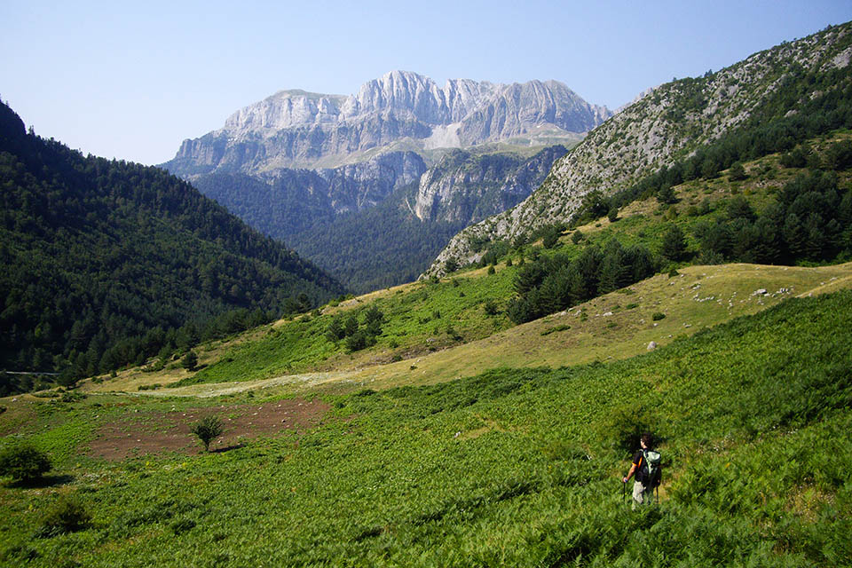
El GR11 remonta el barranco de Petraficha. Detrás, la Sierra de Alano.
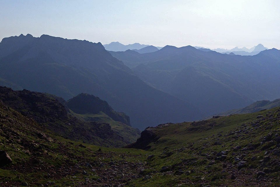
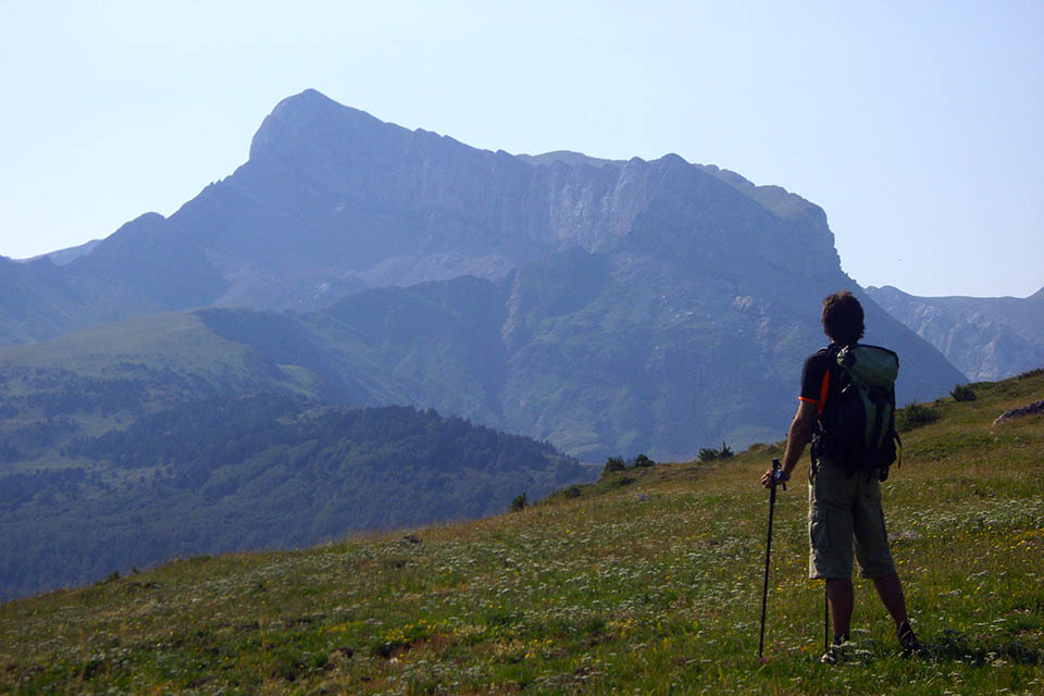
Valle del Aragón Subordan desde el collado de Petraficha. A la izquierda en primer plano, Larraille y el Mallo de las Foyas.
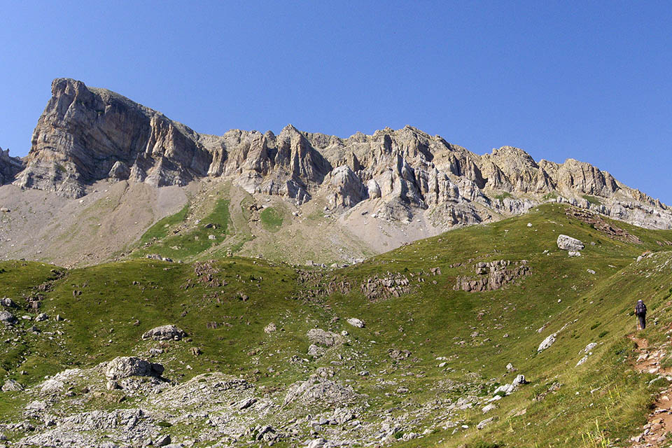
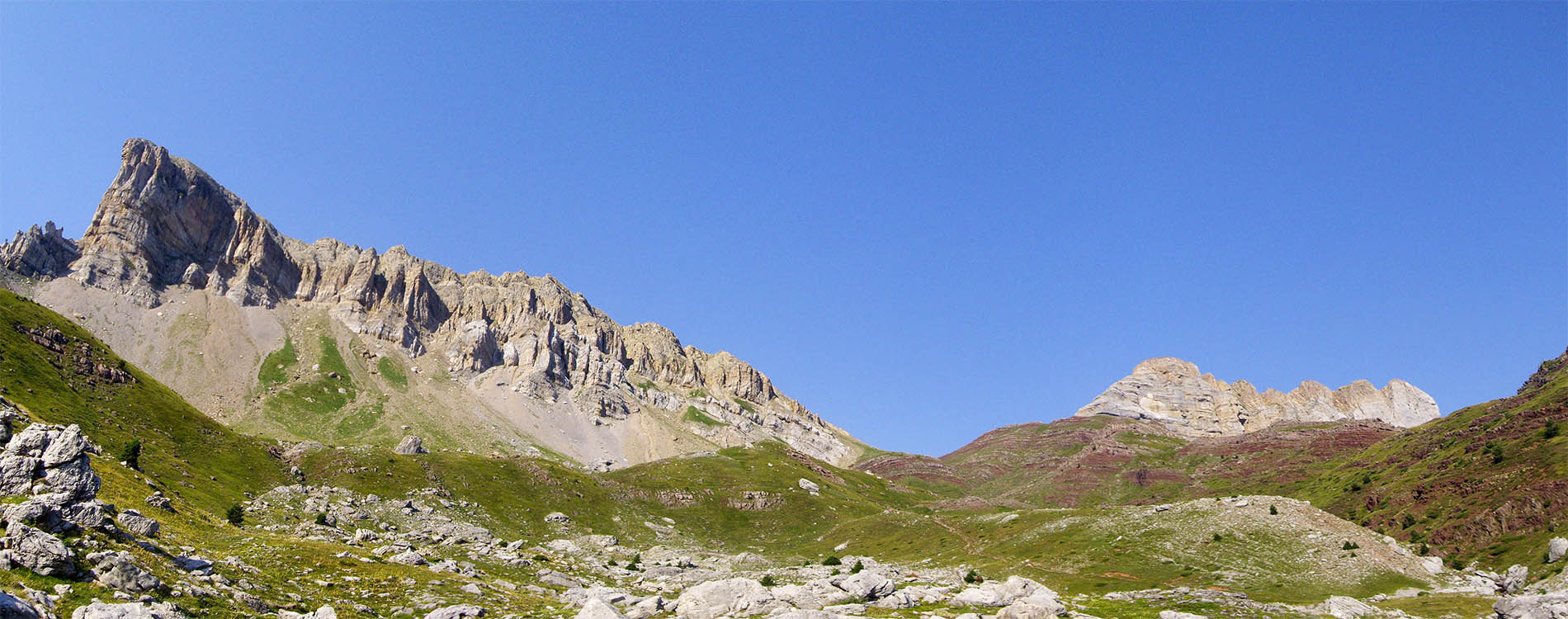
Acherito, Petrechema, Agujas de Ansabere y Pic de La Chourique

Valle del río Aragón Subordán. A la derecha el Castillo de Acher.
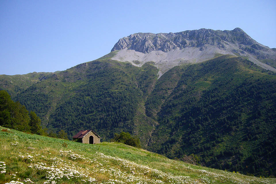
Refugio de lo Sabucar. Detrás, el Mallo de las Foyas.
Guarrinza. Detrás, Lenito.